This is the main page for a series of virtual runs with some connection to Acadia National Park or national parks in general, a medal or other finisher’s memento to mark the completion of a race, and a charitable giving element. The first-ever virtual run we hosted was the Acadia Centennial Trek, to celebrate the park’s 100th anniversary in 2016, as described below. Here are links to blog posts and registration pages for other virtual runs as we develop them.
We’ve been relying on Racery’s virtual race platform since 2016! And this series of virtual races has raised more than $4,550 for charity since then.
Acadia to Katahdin, via El Camino, Voyageurs, Grand Canyon – July 1 – Dec. 31, 2025 – SIGN UP NOW!

Help raise funds for the non-profit Friends of Acadia, Millinocket Memorial Library, Friends of Katahdin Woods and Waters and National Parks Traveler. New option at registration to put in your hometown, so that your avatar starts off in your state of residence, before you log your first miles in Acadia. Also new: Option to synch with Strava – but still remember to log directly in Racery for the full virtual race community experience – and a photo gallery in the dropdown menu so it’s easy to catch up with fellow virtual racers’ uploaded images. Virtually climb the 26 peaks of Acadia on Mount Desert Island in the first 59 miles; then jump across the Atlantic to Spain for a marathon distance along El Camino; back to the US to celebrate the 50th anniversary of Voyageurs National Park in Minnesota; west to Grand Canyon National Park; and head back to Maine to virtually tour Katahdin Woods and Waters National Monument, run the Millinocket Marathon & Half and finish the race atop Katahdin. You can backdate miles to July 1. SIGN UP NOW!
Photos of the latest reward options for the newest virtual race

What would pair well with your Maine STRONG medal? Choose from among the 11 ribbons below: 1) Lumberjack plaid; 2) Camouflage; 3) I LOVE Millinocket Memorial Library; 4) I LOVE Friends of Acadia; 5) 26 peaks of Acadia and 3 peaks of Baxter; 6) Rainbow; 7) Tie dye; 8) Strong as a crusher claw; 9) Strong as a bull moose; 10) Neon moose; or 11) Multi-moose. Whichever combination of medal and ribbon: $16 each, including US shipping & handling, plus the option to add a lobster or moose patch – or both! – $5 each, see below. SIGN UP NOW


Optional medal ribbon add-on: A lobster or moose patch – or both! – each patch an additional $5. Exact layout of patches on each medal will vary. Moose patch may not stand out on a dark background from a distance, and a lobster patch may not stand out on a red background, although they are visible on close inspection. SIGN UP NOW

4″ x 4″ 26 peaks of Acadia Magnet with extra-strong magnet OR Coaster with cork backing – $16 each incl. US shipping & handling

4″ x 4″ Four Thousand Footers of Baxter State Park Magnet OR Coaster, featuring the work of Maine artist SKong – $16 each incl. US shipping & handling

4″ x 4″ Jordan Pond Magnet OR Coaster, based on watercolor by Maine artist SKong – $16 each incl. US shipping & handling

4″ x 4″ Katahdin Magnet OR Coaster, based on painting by Maine artist SKong – $16 each incl. US shipping & handling
Acadia to Katahdin, via Nova Scotia and Alaska – Jan. 1 – June 30, 2025 – ENDED

Help raise funds for the non-profit Friends of Acadia, Millinocket Memorial Library and National Parks Traveler. New option at registration to put in your hometown, so that your avatar starts off in your state of residence, before you log your first miles in Acadia. Also new: Option to synch with Strava – but still remember to log directly in Racery for the full virtual race community experience – and a photo gallery in the dropdown menu so it’s easy to catch up with fellow virtual racers’ uploaded images. Virtually climb the 26 peaks of Acadia on Mount Desert Island in the first 59 miles; then jump northeast to the Cabot Trail and Cape Breton Highlands National Park in Nova Scotia; scoot northwest to Alaska’s Wrangell-St. Elias National Park and Preserve; and then head back to Maine to virtually run the Millinocket Marathon & Half and finish the 250.3-mile race atop Katahdin. You can backdate miles to January 1.
Acadia to Katahdin via Paris; Death Valley; Craters of the Moon – July 1 – Dec. 31, 2024 – ENDED

Help raise funds for the non-profit Friends of Acadia, Millinocket Memorial Library and National Parks Traveler. New option at registration to put in your hometown, so that your avatar starts off in your state of residence, before you log your first miles in Acadia. Also new: Option to synch with Strava – but still remember to log directly in Racery for the full virtual race community experience. Virtually climb the 26 peaks of Acadia on Mount Desert Island in the first 59 miles; then jump across the Atlantic to Paris for the Olympic racewalking marathon mixed relay – the event’s Olympic debut in 2024!; scale Mount Lafayette in New Hampshire’s White Mountain National Forest; head west to Death Valley National Park in California and Craters of the Moon National Monument and Preserve in Idaho; then head back to Maine to visit Katahdin Woods and Waters National Monument, virtually run the Millinocket Marathon & Half, and finish the 239.4-mile race atop Katahdin. You can backdate miles to July 1.
Acadia to Katahdin via Mt. Washington, Glacier, Bryce, Haleakala – Jan 1, 2024 – June 30, 2024 – ENDED

Help raise funds for the non-profit Friends of Acadia, Millinocket Memorial Library and National Parks Traveler. New option at registration to put in your hometown, so that your avatar starts off in your state of residence, before you log your first miles in Acadia. Virtually climb the 26 peaks of Acadia on Mount Desert Island in the first 59 miles, then head west for a virtual tour of Mt. Washington State Park and Glacier, Bryce and Haleakala National Parks, before circling back east to Hampton National Historic Site in Maryland, and north to Maine to virtually run the Millinocket Marathon & Half, tour Katahdin Woods and Waters National Monument, and finish the 223.1-mile race atop Katahdin. You can backdate miles to Jan. 1.
Acadia to Katahdin Virtual Race via Big Bend and Yosemite – July 1, 2023 – Dec. 31, 2023 – ENDED

Help raise funds for Friends of Acadia and Millinocket Memorial Library. New option at registration to put in your hometown, so that your avatar starts off in your state of residence, before you log your first miles in Acadia. Virtually climb the 26 peaks of Acadia in the first 57 miles, then head west for a virtual tour of Big Bend and Yosemite, before heading back to Maine and finishing the 233.1-mile race atop Katahdin.
Acadia to Katahdin Virtual Race via Bryce Canyon National Park – Jan. 1, 2023 – July 30, 2023 – ENDED

Head from Cadillac to Katahdin, and then west for a marathon-length distance in Bryce Canyon National Park, before returning to scale Katahdin a second and final time. Help raise funds for Acadia National Park and Millinocket Memorial Library, and earn a medal or two or more.
Acadia to Katahdin Virtual Race via Glacier Bay, Yellowstone, Shenandoah – ENDED

Take a virtual National Parks tour, from Glacier Bay in Alaska to Yellowstone in Wyoming, Shenandoah in Virginia to Acadia in Maine. You’ll have climbed the 26 peaks of Acadia, virtually, if you can complete the first 50 miles, getting scenic pop-up Google Street Views as you land along the virtual race map. And you’ll get to virtually run a marathon distance in Stephen King territory, as well as along the real-life MDI Marathon and Millinocket Marathon routes, before finishing atop Katahdin.
Acadia to Katahdin Virtual Race via Hawaii, Oregon, Utah, S. Dakota – ENDED – see special teams roster below, announced July 6, 2022

The latest Acadia to Katahdin Virtual Race takes you to Hawaii Volcanoes, Crater Lake, Bears Ears and Badlands. Help raise funds for Acadia and Millinocket, and earn a medal (or two).

For every 25+ day streak, or 25+ miles in 1 day, or for every landing on Forrest Gump Point, there’s a small star patch that can be added to the optional finisher’s medal.

Congratulations to virtual racers with the longest streaks, and multiple laps of the virtual race course! You’ve earned the right to lobster, moose or other patches.
Acadia to Katahdin Virtual Race – 2021 Virtual Edition of the Sea to Summit Series – ENDED

Help support the Friends of Acadia, Millinocket Memorial Library and Our Katahdin, and earn a medal for virtually climbing the 26 peaks of Acadia. Co-sponsored with runmdi.org, as the 2021 virtual edition of the Sea to Summit Series. (Image courtesy of Racery)
Acadia to Katahdin Virtual Race (via Denali, Gettysburg and Zion) – Jan. 1 – Aug. 1, 2021 – ENDED
2020 Acadia to Katahdin Virtual Race – Aug. 9 – Dec. 31 – ENDED
Help raise funds for Friends of Acadia, Millinocket Memorial Library, Our Katahdin and Mount Desert Island Marathon, all 501(c)(3) charities. Join now and you can backdate miles to Aug. 9. Co-sponsored with runmdi.org, as the virtual edition of the Sea to Summit Series. New virtual race route includes a special detour to the Boston Marathon route – Maine and Boston STRONG! While the virtual race is not affiliated with the Boston Marathon, Crow Athletics sponsors a Boston New Years Run, with the 17th running of it scheduled to begin at 1 Main Street, Hopkinton, MA, on Jan. 1, 2021, at 6 AM.
Amazin’ Maine Virtual Race– April 16 – Aug. 8, 2020 – ENDED

Show your love for Friends of Acadia or Millinocket Memorial Library, or show your pride in having run or hike with Robin Emery, the Maine Running Hall of Famer who also goes by the virtual race name @Fossil. Opt for one of these special medals ($12 each) when signing up for the Amazin’ Maine Virtual Race, to help support your favorite cause. You can backdate miles to April 16.

Or you can opt for one of the classic medals ($10 each) with raised profile of the Bubbles and Katahdin, with the neon moose (left), the multiple moose (center), or the lobster ribbon. At least 5% of gross proceeds from the Amazin’ Maine Virtual Race go to support the Friends of Acadia, Millinocket Memorial Library and the Robin Emery Prize, to be awarded to a 5th through 12th grade girl who runs in the Down East YMCA Main Street Memorial Mile.
Acadia to Katahdin Virtual Race 2019-2020 – Aug. 2, 2019 – April 15, 2020 – ENDED

Are you up to the challenge? Virtually climb the 26 Acadia peaks, run the MDI and Millinocket Marathon and scale Katahdin twice? (Image courtesy of racery)

Everyone who signs up automatically gets a digital race bib – what motivation! And even if you can’t complete the 328.5 miles by Dec. 31, you will will receive a digital certificate at the end marking your participation, plus other fun motivation along the way. Sign up now. (Image courtesy of racery)
Acadia to Katahdin Virtual Race 2018 – ENDED
Cadillac to Katahdin Virtual Run – Aug. 15, 2017 – July 19, 2018 – ENDED

Acadia Centennial Trek Medal
ACADIA CENTENNIAL TREK VIRTUAL RACE – ENDED
There’s also a Facebook group page for the virtual races that we’ve developed, where you can ask questions.
You can run, hike or walk anywhere in the world, log your miles online, and watch your race avatar move along the virtual race route up Acadia’s peaks, along the carriage roads and elsewhere around the great state of Maine.
If you like the concept of virtual runs, as powered by racery.com, and want to sign up for one of the paid races, you will also be helping to raise funds for Friends of Acadia and other charities.
Read the blog posts about the original virtual 100-mile Acadia Centennial Trek, to learn what it’s all about, listed in chronological order below:
“Join virtual Acadia Centennial Trek to celebrate, help park” – 2/26/16
“Ready, set, go! First ever of Acadia virtual races about to start” – 2/28/2016
“Off to the races! Strong start to 100-mile Acadia virtual race” – 3/1/2016
“Trail magic casts spell on Acadia National Park hiking trails” – 3/27/2016
“Acadia Triple Crown: Run, walk for park, a cause – and bling!” – 5/22/2016
“Meaning of the Trek, in the year of the Acadia Centennial” – 6/11/2016
“New Acadia National Park hiking group open to all” – 8/5/2016
“Running in Acadia National Park a real and virtual delight” – 9/7/2016
“Global field of 400 covers 30,000 miles in Acadia virtual runs” – 11/11/2016
“Centennial Trek Challenge: Run, walk 100 miles for Acadia” – 11/13/2016
Here’s an online guide to the Acadia Centennial Trek race route, by mile marker. Go to this link to expand the Garmin Connect map, pictured below, that we used to custom design the racery.com route. Follow the instructions in the caption below to show 1-mile increments and elevation.

We used Garmin Connect to custom design a 100-mile route for the virtual race that’s being hosted on Racery.com. To see 1-mile increments and elevation, click on this link, check the “Mile Markers” box, zoom in on the map with the + sign, and select “Terrain” from the dropdown menu below the icon that looks like a stack of papers.
Click on mile markers below, to go to a Google Maps photo link for that general location, where available.
If we have time, maybe we’ll add more of our own photos or videos to this guide, especially if this becomes a series of Acadia Centennial Trek virtual runs.
And perhaps we’ll invite local businesses and organizations to share what mile marker on the virtual route they’re near, either in comments below, or on a Facebook page we’re creating for the year-long event. That would truly make this a virtual community, whether you’re a runner or not, and on Mount Desert Island or not.
This race and the optional finisher’s medal are among our commitments as an official Acadia Centennial Partner.

Be part of history by joining the first-ever 100-mile virtual Acadia Centennial Trek, and have the option of buying a finisher’s medal to help raise funds for the park. Might there be other Acadia virtual runs in the future?
Who needs to physically be in Acadia, when you can have Acadia virtually always on your mind? Sign up for the Acadia Centennial Trek, check out this online guide to the 100-mile route, and you’ll be transported there. Even if the race has already started, you can sign up at any time. Just go to the drop-down menu under “Runners” on the Racery.com map, and enter your e-mail for free registration. You have until Dec. 31, 2016, to complete the miles.
Zoom into this Garmin Connect map to find the below mileage markers superimposed on the virtual Acadia Centennial Trek route. Where Google Maps photos are available near mileage markers, you can see them below by clicking on the links.
Or if you prefer, you can see what your cumulative mileage on the virtual race is after you log the day’s distance. Then click on the closest mileage marker below, to get the Google Maps view, where available, of that spot on the virtual route.
Unfortunately, we don’t have the capability to allow participants to add photos to this blog, although you can make comments below. But you can add photos at the Facebook events page we first set up for the inaugural running of the trek, and indicate which mile it represents, whether in virtual reality, or actual reality. We’ll be creating an on-going Facebook group page soon for the Trek.

The virtual Acadia Centennial Trek on Racery.com begins at the top of Cadillac, goes over sections of the Park Loop Road and carriage roads, and along parts of the routes of MDI YMCA’s Acadia and Fall Half Marathons, and ends at the finish line for the MDI Marathon.
For example, if you have a photo of a Cadillac sunrise you want to share, you could upload the photo to the Facebook events page and indicate that as being at the Start, or Mile 0 marker. Or if you have a photo of yourself crossing the MDI Marathon finish line, you could upload that and indicate that as being at the Finish, or Mile 100 marker.
Or you can simply upload a photo of where you actually ran or hiked or step-counted, wherever you are in the world, as you log your miles for the virtual race. Running on your treadmill? Upload a photo of that and say what mile on the virtual route that represents!
CAUTION: Don’t necessarily follow the virtual route on any of your real-life exploration of Acadia. The route was drawn for the convenience of coming up with exactly 100 miles, covering all 26 peaks of Acadia on Mount Desert Island, some of the Park Loop Road, carriage roads and the routes of Acadia and Fall Half Marathons, and ending at the MDI Marathon finish line. It could be that some of the virtual route doesn’t follow any official trail, or goes up the hardest way, rather than the recommended way, up a particular mountain, or along less-than-scenic campground roads. We’d recommend getting a good topo map and hiking guide, before setting out on the trails. We’re fond of our own guides, of course (see sidebar), but you can search Amazon.com for other books or maps, or try a free app like Chimani.
Online mileage marker guide to Acadia Centennial Trek virtual runs

Sunrise on Cadillac Mountain, where the virtual Acadia Centennial Trek starts (NPS photo)
Mile 0 – Cadillac sunrise
Mile 1 – Cadillac Mountain Road
Mile 4 – Start of 1-way Park Loop Road
Mile 5 – About 1/8 mile after Gorge Path junction on Park Loop Road
Mile 6 – About 1/4 mile before junction with Great Meadow Drive; the route for MDI YMCA’s Acadia Half Marathon, being run this year on Sunday, June 5, comes in from Kebo Street, about 1/4 mile before this point in the virtual race

A hiker ascends the Orange & Black Path in Acadia National Park, near Mile 8 of Acadia Centennial Trek
Mile 7 – About 1/4 mile after the Sieur de Monts entrance
Mile 8 – Near Orange & Black Path
Mile 9 – Approaching the Entrance Station on way to Sand Beach
Mile 10 – Great views of Great Head and Sand Beach on the Park Loop Road here, which the Acadia Half Marathon takes you by as well
Mile 11 – Turn right off Park Loop Road onto Gorham Mountain Trail
Mile 12 – Run past the Waldron Bates memorial and over the peak of Gorham to reach this point; don’t mess around with the historic Bates-style cairns
Mile 13 – Over the Beehive and along the southern shore of the Bowl to get to this point; if climbing the Beehive in real life gives you the hives, then this virtual method is the way to go
Mile 14 – This puts you right at the top of Champlain, where the Champlain South and North Ridge Trails, and the Precipice Trail meet; if climbing the Precipice in reality has you swooning, this is the way to do it

George B. Dorr on Beachcroft Path in Acadia National Park. This same rock is at about the 14.6 mile mark of the virtual race route. (NPS photo)
Mile 15 – Come off Champlain and Huguenot Head via the Beachcroft Path, cross ME 3, and reach the mouth of the Tarn here
Mile 16 – Scale Kurt Diederich’s Climb, hang a left on Schiff Path as you make your way up Dorr Mountain, named after George B. Dorr, the “father of Acadia”
Mile 17 – From the peak of Dorr, head along the Dorr North Ridge Trail and reach this point just before the junction with the Kebo Mountain Trail
Mile 18 – Up and over Kebo Mountain, cross the 1-way section of the Park Loop Road (watch for traffic coming from the left) and turn right on the newly reopened Kebo Brook Trail; then turn left on the Great Meadow Loop, cross Cromwell Harbor Road and follow Kebo Street
Mile 19 – Turn right off Kebo Street onto Mount Desert Street (ME 3), reaching this mile marker at the corner of Holland Street on the virtual route; continue straight, turn right on Main Street, and pass the starts of both MDI YMCA’s Fall Half Marathon, being run on Saturday, Sept. 17, this year, and of MDI Marathon, being run on Sunday, Oct. 16, this year

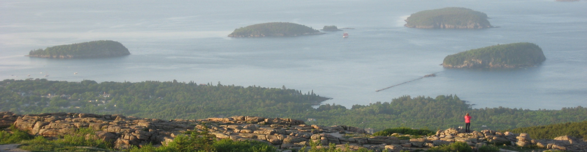
Former Acadia National Park volunteer Jim Allen, standing to the far right, leads a tour of George Dorr’s “Missing Mansion” on the Compass Harbor Trail. A cruise ship and Bald Porcupine Island are in the background. This view is at about the 20.8 mile mark on the virtual route.
Mile 20 – Follow ME 3, the route of the MDI Marathon at this point, and pass this virtual mile marker right after the junction with Cromwell Harbor Road; stay on the sidewalk on the east side of ME 3, and in about half a mile, turn left into the small parking lot and onto the Compass Harbor Trail, to take a tour of the remains of Dorr’s family estate
Mile 21 – Tour of the Old Farm estate wraps up here; take a right on Old Farm Road, then a left to continue on ME 3, back on the MDI Marathon route (this also happens to be part of the return loop for the Acadia Half Marathon)
Mile 22 – Pass Jackson Laboratory and reach this virtual mileage marker just before the Sieur de Monts park entrance. Watch for wild turkeys crossing the road.

When we saw this flock of wild turkeys near Acadia National Park’s Sieur de Monts entrance, we had to stop and take a photo. A group of turkeys can also be called a rafter, gang, posse, crop or dole. This is at about Mile 22 on the virtual route.
Mile 23 – Pass the Tarn on your right and through the gorge between Dorr Mountain and Huguenot Head, to get to this mileage marker, just before the Canon Brook Trail parking area
Mile 24 – On the way to Otter Creek
Mile 25 – Pass by historic Otter Creek Hall to get to this point on the virtual route
Mile 26 – About 1/4 mile after the entrance to Blackwoods Campground and the Cadillac South Ridge Trailhead, and still following the MDI Marathon route on ME 3
Mile 27 – The virtual route stays on ME 3 while the real-live MDI Marathon route bears left on Cooksey Drive; turn right at the pedestrian walkway to head up the trail to Day Mountain (look for the hidden Champlain Monument to the right as you get on the trail). We introduced our nieces Sharon and Michelle to wild Maine blueberries fresh off the bush on the Day Mountain Trail.

Our nieces were glad to have the option of riding the Island Explorer after the exertion of trying to push Bubble Rock, at virtual Mile 31.
Mile 28 – Up and over Day Mountain, crossing carriage roads and, finally, the Park Loop Road, just after this virtual mile marker; watch for horse-drawn carriages and bicyclists on the carriage roads, and cars on the right on this 1-way section of the Park Loop Road
Mile 29 – Up the Triad, then along the Pemetic East Ciff Trail on the way to Pemetic
Mile 30 – Heading down from Pemetic along the Pemetic Northwest Trail
Mile 31 – Cross the 2-way Park Loop Road to the Bubble Rock parking lot; follow Bubbles Divide (formerly known as Bubble Rock Trail), turn left onto the Jordan Pond Carry Trail until it dead ends at the shore of Jordan Pond, and take a sharp right steeply up South Bubble, where you’ll find Bubble Rock at this virtual mile marker. This isn’t the recommended route up South Bubble in reality; best to stay straight on the gentler Bubbles Divide all the way up.
Mile 32 – Up and over North Bubble, on the way to Conners Nubble. Watch for wild Maine blueberries in season, July into August.

Blueberries and Bates-style cairn on Conners Nubble, at Mile 32.3 on the virtual route.
Mile 33 – Descend Conners Nubble and hook a left on the carriage road, and follow that to intersection 8; bear right to 4-way intersection 10, then left to head south on the carriage road; overlapping with part of the real-life MDI YMCA’s Fall Half Marathon route on the carriage road between Eagle Lake and intersection 8
Mile 34 – On the carriage road to Deer Brook Bridge, at about Mile 34.5 on the virtual route; turn right at the bridge and head up the Deer Brook Trail (but be sure to explore the double-arched bridge, by following steps down to the left first)
Mile 35 – Reach this point soon after passing the Jordan Cliffs Trail, and turn left to head south on the ridge toward Penobscot
Mile 36 – Up and over Penobscot and reach this point soon after the junction with the Spring Trail that heads left toward the Jordan Pond House
Mile 37 – Follow the recently reopened historic section of the Penobscot Mountain Trail to the carriage road; turn right on the road and follow it toward the Amphitheater, a glacially carved chasm spanned by one of Mr. Rockefeller’s bridges, the longest one at 245 feet
Mile 38 – Get off the carriage road and onto the steep Amphitheater Trail, bear left at the 4-way intersection at Birch Spring to take a squiggle up scenic Cedar Swamp Mountain, then back to Birch Spring and continue straight on the Sargent South Ridge Trail

From left to right, Liam Hassett, of Cleveland, Ransom Burgess, of Bar Harbor and Billy Brophy, of Hyattsville, Maryland swing sledge hammers to bust stones into tiny pieces for creating a new 30-foot-long causeway atop Sargent Mountain in Acadia National Park. The three served in the Friends of Acadia’s Youth Conservation Corps a couple of years ago, and this was one of their projects. Admire their handiwork as you step along the causeway at Mile 39 of the virtual route, as you approach the summit from the south.
Mile 39 – Almost at the summit of Sargent, the second highest peak in Acadia, at 1,373 feet
Mile 40 – From Sargent, head west down the Grandgent Trail and over Gilmore Peak and Parkman Mountain, to the junction with the Bald Peak Trail; bear left to Bald Peak
Mile 41 – After descending the Bald Peak Trail, crossing a couple of carriage roads on the way, turn right at the dead end with Hadlock Brook Trail to get to ME 198 at the Norumbega Mountain parking area
Mile 42 – Climb the recently rehabilitated Goat Trail to the top of Norumbega and descend along the ridge
Mile 43 – Bear right on the Hadlock Ponds Trail, cross the dam and skirt the southern shore of Lower Hadlock Pond, on the way to ME 198; turn right and head south on ME 198, picking up the MDI Marathon route again as it comes in on the left from ME 3 (Peabody Drive)

You may catch a snapping turtle sunning on a rock in springtime in Acadia National Park, as we did along Lower Hadlock Pond, at Mile 42.75 on the virtual route
Mile 44 – Reach this point in Northeast Harbor just past Delights Road, and just before the Mile 12 marker of the real-life MDI Marathon; bear left on Main Street, take a squiggle left at Kimball, then a squiggle right at Neighborhood, and one more squiggle left at Rock End Road, just as the real-life marathon route does; turn left on Barnacles Way, right on S. Shore Road
Mile 45 – At this point on S. Shore Road, you’re just around the corner from the start of the real-life MDI Half Marathon; at the end of S. Shore Road, turn right onto Manchester Road, and pass the half marathon start at Manchester and Neighborhood Roads; you’re on the real-life routes for the MDI Marathon and Half at this point
Mile 46 – Somes Sound comes into view; follow Manchester Road as it merges into Sargeant Drive
Mile 47 – Great views of Somes Sound all along Sargeant Drive, and one of the reasons MDI Marathon got named 2015 New England Runner Race of the Year
Mile 48 – More great Somes Sound views; one of the main Acadia Centennial events is the Somes Sound Windjammer Parade on Aug. 2 – will it be visible somewhere along Sargeant Drive?
Mile 49 – Heading toward ME 198 and veering off from the MDI Marathon and Half Marathon course at this point, in order to virtually bushwhack trailless Youngs Mountain (elevation 680 feet) and McFarland Hill (elevation 724 feet); left on ME 198 for about 1/4 mile, carefully cross over the busy highway to the Giant Slide Trailhead
Mile 50 – Follow the Giant Slide Trail to the first carriage road intersection, and take a left onto the carriage road – halfway there!
Mile 51 – Continue on the carriage road to intersection 11, and bear left toward Aunt Betty Pond
Mile 52 – Aunt Betty Pond
Mile 53 – Carriage road

Rare sighting of a moose in Acadia National Park, as captured by author and blogger Donald P. Lenahan, as he was exploring Youngs Mountain in August 2012, near Virtual Mile 56. (Photo by Donald P. Lenahan)
Mile 54 – Carriage road, bear left at intersection 9, cross under ME 233 (Eagle Lake Road); at this point virtual route goes off trail, to bushwhack up Youngs Mountain and McFarland, and not recommended in real life, unless you have a GPS or compass and map, and know your way around through thick woods
Mile 55 – Still off trail
Mile 56 – Might this have been where the moose, spotted on Youngs Mountain by Donald P. Lenahan, was grazing?
Mile 57 – Bushwhack down McFarland Hill, turn right on ME 233 (Eagle Lake Road), as the virtual route now heads over to the Quietside of Mount Desert Island. In real life, you would of course need to be careful of cars, buses and trucks on the road, whether you’re biking, running or walking. Park headquarters is a little east (left) on ME 233.
Mile 58 – Norway Drive comes in on the right
Mile 59 – You’ll pass by MDI High School in about another 1/4 mile
Mile 60 – Turn right on ME 3, pass mansion with Somes Sound view
Mile 61 – Continue on ME 3 on the way to the Quietside, left on ME 102 and travel through the pretty village of Somesville, with its photogenic footbridge
Mile 62 – Nearing the Pretty Marsh turnoff, and the flashing traffic light; stay straight (south) on ME 102 for the next couple of miles

Acadia Mountain is on the only east-west mountain ridge in all of Acadia National Park
Mile 64 – Left onto the old fire road just before the Acadia Mountain parking area, and where the new Island Explorer bus stop for Acadia Mountain is, at about mile 64.5; take a quick left to ascend the Acadia Mountain Trail
Mile 65 – Acadia Mountain offers stunning views of Somes Sound; descend and take the Valley Cove Trail along the Sound
Mile 66 – Keep skirting the Sound
Mile 67 – Climb up Flying Mountain
Mile 68 – Descend Flying Mountain, take a right on the old gravel fire road for about 1/8 mile, then ascend the Valley Peak Trail to the left. Bear left at the top of Valley Peak (turn around to see limited views back down toward Cranberry Isles), to head toward the wooded summit of St. Sauveur at about mile 68.4. The virtual route continues straight and then left on the Ledge Trail at about 68.6 miles, to descend to ME 102. But if you’re on this trail in real life, you will want to take the spur trail that leads east from St. Sauveur, to get the views down to Somes Sound.
Mile 69 – Reach ME 102 at the St. Sauveur Mountain parking area, turn left on the highway, then right on Echo Lake Beach Road, and take it to the end of the parking lot

The only firetower in Acadia National Park is on Beech Mountain, at Virtual Mile 71.3
Mile 70 – Turn left on the Beech Cliffs Trail and climb the ladder trail to the top, leaving Echo Lake Beach below. Turn right at the top of the ridge, bear right at the intersection to do the Beech Cliff Loop, then upon closing the loop, bear right to the Beech Mountain parking lot and at the Beech Mountain Loop junction, bear right (west) to go the more scenic way up.
Mile 71 – You may see raptors migrating in fall on the way up to Beech Mountain; bear left up to the firetower, where the top platform is sometimes accessible during an open house; descend on the Beech South Ridge Trail down to the Valley Trail; turn right on the Valley Trail as the virtual route heads over to the less-frequented Long Pond and Western Mountain area of Acadia
Mile 72 – Descend to road and bear left, then a quick right to cross over another road and continue on the Valley Trail down to Long Pond. We experienced some trail magic here on the shore of Long Pond once, when we ran into Acadia trails crew foreman Gary Stellpflug on his day off, just as he was about to set his canoe off into the pond. We didn’t recognize him at first, but he recognized us, as a result of our working with him, Charlie Jacobi and Chris Barter (also Acadia’s first poet laureate!) so closely on our Falcon hiking guides to Acadia over the years.
Mile 73 – Turn left at the parking lot and skirt the southern shore of Long Pond; pass the pumping station and follow the Long Pond Trail to the Perpendicular Trail to head up Western Mountain; take a left and start the steep ascent up this amazing trail built with about 500 stone steps by the Civilian Conservation Corps
Mile 74 – Up and over Mansell Mountain (949 feet elevation), which together with Bernard make up what’s known as Western Mountain; take in the view down to Long Pond just before the summit; turn left down the Mansell Mountain Trail, as this virtual route takes detours to allow the 100 miles to end exactly at the MDI Marathon finish line; turn right on the Gilley Trail, then quick right back up Western Mountain on the Razorback Trail – less than a marathon’s length to go!
Mile 75 – Bear left at the junction at the top of the Razorback Trail to head to the Great Notch between Mansell and Bernard Mountains, where there are convenient wooden benches to take a rest; turn left down the Great Notch Trail, then take a right on a spur trail to the Sluiceway Trail, then another right up the Sluiceway – you’re 3/4 of the way there!
Mile 76 – At Little Notch, turn left on the Bernard Mountain Trail and reach that 1,071-foot mountain in 0.2 mile; continue down the Bernard Mountain Trail; bear right on the West Ledge Trail, as the virtual route heads off Western Mountain to hit the roads and make the big loop through Seal Cove, West Tremont, Tremont, Bass Harbor and Manset, on the way to the finish line in Southwest Harbor
Mile 77 – One of the best sunsets in Acadia can be had on the West Ledge Trail; descend to a dirt road and turn left

Bass Harbor Head Light is picture-postcard perfect. (NPS photo)
Mile 78 – Turn right at the first junction, up Bald Mountain, where there’s a parking area, and down to Seal Cove Road; turn right on Seal Cove Road to head to ME 102
Mile 79 – Left on ME 102 as the route heads through West Tremont and Tremont, on the way to one of Acadia’s iconic sites, Bass Harbor Head Light
Mile 84 – Bear right onto 102A as the virtual route makes its way toward Bass Harbor and Seawall
Mile 85 – Where 102A curves sharp left, go straight on Lighthouse Road
Mile 86 – How perfect, Mile 86 is right at the Bass Harbor Head Lighthouse; restrooms at edge of parking lot; wooden stairs down to view of the lighthouse, which isn’t open to the public except during rare open house, but was opened for a private tour for President Obama and his family during their July 2010 vacation in Acadia

Not only did President Barack Obama and family hike Cadillac during their July 2010 vacation, they also toured Bass Harbor Head Light and the Ship Harbor Trail. Wonder if anyone can convince them to visit Acadia again, or at least do the Acadia Centennial Trek? We sent a copy of our “Hiking Acadia National Park” book to First Lady Michelle Obama a couple of years ago, with a note about how the book might come in handy for their next trip, but never did get a response from her office. She must get tons of mail, and it’s hard to keep up. (White House photo)
Mile 87 – Backtrack on Lighthouse Road, take a right on ME 102A; turn right onto the easy Ship Harbor Trail, which is partly wheelchair and baby stroller-accessible; bear right to do the figure-8 loop to get the best views – less than a half marathon’s length to the finish!
Mile 88 – Ship Harbor Trail was built in 1957 as part of the decade-long Mission 66 program to celebrate Acadia’s and the National Park Service’s 50th anniversary; you may see eiders floating at the mouth of Ship Harbor
Mile 89 – Back on ME 102A, turn right to head to the parking area for the Wonderland Trail, at this mile marker
Mile 90 – You can explore the tidepools exposed at low tide for hours, on the Wonderland Trail; you can also sit among the snails exposed on the tidal flats, if you’re not in a hurry, or watch a video of a snail’s locomotion (from the Acadia on My Mind YouTube channel)
Mile 91 – Back on ME 102A, turn right, head to Seawall Campground for a long, less-than-scenic detour to make the 100 miles fit the route; turn left into the campground
Mile 92 – Near the gated Hio Road at the far end of Seawall Campground
Mile 93 – Exit campground and turn left on ME 102A
Mile 94 – Less than 10K length to the finish!
Mile 96 – Bear right on ME 102 to head toward the finish line in Southwest Harbor
Mile 97 – Near Three Rod Road, and less than 5K length to the finish!
Mile 98 – Right on Clark Point Road, left on Dirigo Road, right on South Causeway Lane and across the causeway to North Causeway Lane, left on Fernald Point Road

If you run 26.2 real miles you have earned the right to wear this crusher claw. This is MDI Marathon’s finisher’s medal. Stay tuned for the medal you can purchase for finishing the virtual 100 miles of the first-ever Acadia Centennial Trek to help raise funds for the park (Photo courtesy of MDI Marathon)
Mile 99 – Left on ME 102 (Main Street) for the sprint to the finish!
Mile 100 – Finish line of the virtual 100-mile Acadia Centennial Trek, and the real-life MDI Marathon and Half Marathon. Congratulations on running the first-ever Acadia virtual race – you made history!
Stay tuned for details of optional finisher’s medal, that you can purchase to help raise funds for Acadia. It’s going to feature the Acadia Centennial logo, as a licensed product.
Thanks for participating in this inaugural event! Maybe we’ll do it again, with a series of Acadia virtual races with medals. It’s a way to keep Acadia on your mind as you work out, no matter how, where or when!
CAUTION: Don’t necessarily follow the virtual Acadia Centennial Trek route on any of your real-life exploration of Acadia. The route was drawn for the convenience of coming up with exactly 100 miles, covering all 26 peaks of Acadia on Mount Desert Island, some of the Park Loop Road, carriage roads and the routes of Acadia and Fall Half Marathons, and ending at the MDI Marathon finish line. It could be that some of the virtual route doesn’t follow any official trail, or goes up the hardest way, rather than the recommended way, up a particular mountain, or along less-than-scenic campground roads. We’d recommend getting a good topo map and hiking guide, before setting out on the trails. We’re fond of our own guides, of course (see sidebar), but you can search Amazon.com for other books or maps, or try a free app like Chimani. The sponsors of this race assume no liability for accidents happening to, or injuries sustained by, participants in the Trek. The sponsors also do not make any representations as to the conditions of the virtual routes as they apply to the actual routes at Acadia. If you are hiking, running or biking in Acadia National Park as part of the Trek, be sure to follow the rules for park passes, safety, and trail and road usage, available at nps.gov/acad.