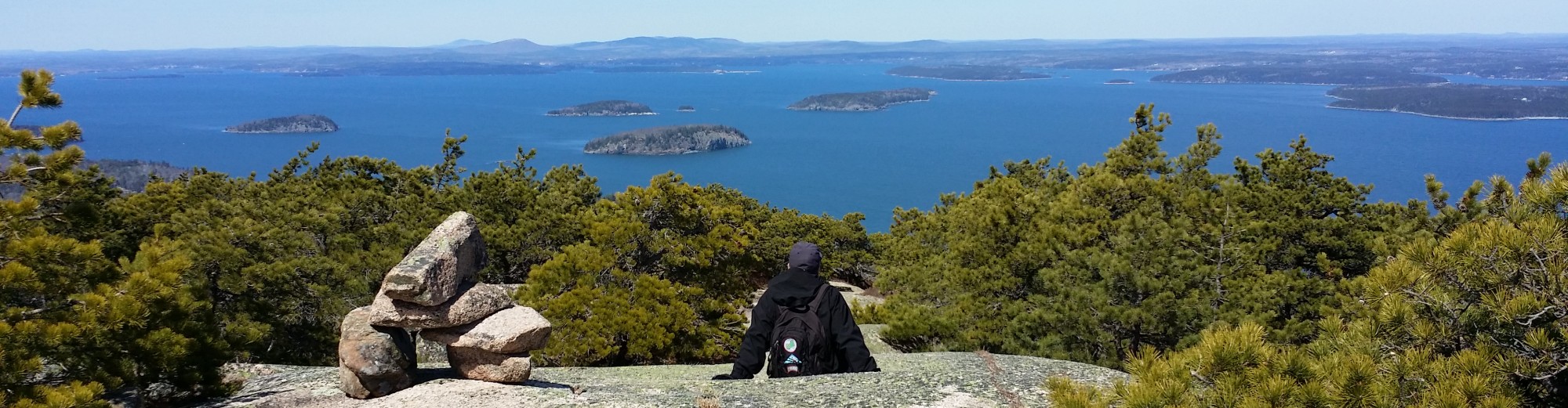
Another in a series of “Ask Acadia on My Mind!” Q&As

Mud season has officially ended in Acadia National Park, now that the carriage roads reopened to pedestrians. Bicyclists and horses still not allowed as of this writing.
If you have a question about Acadia National Park on your mind, whether you’re a first-time visitor or long-time fan, leave a comment below, or contact us through the About us page. We may not be able to answer every question, or respond right away, but we’ll do our best. See our page linking in one place all the Q&As.
Can you recommend specific walks of 2 or 3 hours on the carriage roads? We prefer loops, if possible. We also would welcome suggestions for relaxing hikes, as opposed to trail walks. Thank you very much. – Caroline of Cape Cod
Dear Caroline, The carriage roads in 2020 just reopened to pedestrians on June 5, but not yet to bicyclists or horses.

Ask Acadia on My Mind!
The much-loved Acadia carriage road system offers 45 miles of well-graded broken stone surface, taking you by 17 unique carriage road bridges (16 of them financed and given to the US government by John D. Rockefeller, Jr.), picturesque ponds, brooks, mountains and even a waterfall.
People as famous as President Barack Obama and his family have bicycled the Acadia carriage road around Witch Hole Pond, near the Hulls Cove Visitor Center, one of the carriage road loop hikes we feature below. And the carriage roads have been the training ground for many a long-distance runner, and offer a winter wonderland for cross-country skiiers and snowshoers.
The carriage roads are great for walking, especially as some of the historic vistas are being restored by the park. The Acadia carriage road loop hikes we suggest include some of these vistas, as well as carriage road bridges and short sections along hiking trails for a little variety.
Below are some interactive Google My Maps and color-coded elevation profiles we created just for you, Caroline, for Acadia carriage road loop hikes of between 3 to 6 miles, which should just about take 2 to 3 hours.
Google maps by Acadia on My Mind show Acadia carriage road loops

The official Acadia carriage road map (Image courtesy NPS)
In the upper left hand corner of each interactive map, click on the small arrow pointing to the right, and then the arrow pointing down to see the drop-down with the hike description, the distance and the elevation gain.
And to expand the map to full screen, click on the box in the upper right hand corner. You can zoom in or out using the plus or minus sign at the bottom left of each map. Yellow-starred trail markers indicate special sights to see, while the green one indicates the start of the hike, the red one the end, and the blue ones, major intersections.
The hike description includes the recommended direction to take to minimize the climbing, as well as portions of the hike that might include short sections of rigorous trail walking, although downhill where possible to make it as easy as possible.

The fourth edition of “Best Easy Day Hikes, Acadia National Park,” published May 2019. (Image courtesy Falcon Guides)
To increase the size of the elevation profile, just double click on the images, which were created on a free GPS tool known as GPS Visualizer.
We also share below some photos of things you can see along these Acadia carriage road loop hikes. And if you are looking for other easy hikes, you can search our blog for suggestions, or check out our “Best Easy Day Hikes, Acadia National Park” guide, the latest edition of which just came out this month. It’s available at the Acadia visitor center bookstore, as well as at Sherman’s Book Shop on Main Street, Bar Harbor, and on Amazon.com. (NOTE: Please see sidebar about Amazon.com links)
1) Hulls Cove to Paradise Hill, Witch Hole Pond and Duck Brook Bridge
5.2 mile loop, 443 feet elevation gain, loop described clockwise

Duck Brook cascades below Duck Brook Bridge and the carriage road that loops from Hulls Cove Visitor Center.
President Barack Obama and his family bicycled this stretch of carriage road in July 2010.
Start at the far southwest corner of the Hulls Cove Visitor Center parking lot. At the intersection #1 in 0.5 mile, bear left to go up Paradise Hill and enjoy the restored historic vista overlooking Frenchman Bay.
At intersection #3 at the base of the hill, bear left, passing Witch Hole Pond on the right. Reach Duck Brook Bridge in another mile. There are steps that lead from the bridge down to the brook, which offer fine cascades in the spring or after heavy rains.

Elevation profile, Hulls Cove loop (Image courtesy GPS Visualizer)
Continue on the carriage road, bearing right at intersection #4.
Then bear left at intersection #2 after passing Witch Hole Pond again.
Finally, bear left at intersection #1 to circle back to the Hulls Cove Visitor Center parking lot, heading down Paradise Hill.
2) Jordan Pond to Stanley Brook, Cobblestone, Jordan Pond Bridges
3.11 mile loop, 207 feet elevation gain, loop described clockwise
Start at the carriage road behind the Jordan Pond House. Turn left (south) on the carriage road. At intersection #16, bear right (south), stay straight at intersection #25, and turn left (east) at intersection #26. This now becomes a private carriage road, open to pedestrians but not bicyclists.

Hard to believe that park founder George B. Dorr and others once found Cobblestone Bridge, built in 1917, to be unattractive.
At intersection #29, bear right and reach the Stanley Brook Bridge at intersection #30, about one mile from the start. You can walk down to the Seaside Path from the carriage road, and walk through one of the bridge’s arches.
Continue on the carriage road, bearing right at intersection #31, then left at intersection #27, and right at intersection #28.
At intersection #24, reach the Cobblestone Bridge, which you can admire from underneath by walking down to Jordan Stream Path.

Elevation profile, Jordan Pond to Stanley Brook, Cobblestone and Jordan Pond Bridges (Image courtesy GPS Visualizer)
Continue north back toward Jordan Pond House, bearing left at intersection #23, and then left at intersection #15, to head to the southern shore of the pond and cross the last of the 3 bridges on this loop, the Jordan Pond Bridge with its view of the Bubbles.
And if the Jordan Pond House is open for the season, be sure to stop in for its famous popovers, and take in the spectacular scenery.
It’s best to park at the Jordan Pond House North Lot or, if you visit while the Island Explorer is running late June through Columbus Day, to take the fare-free shuttle to the Jordan Pond House stop.
3) Jordan Pond to Deer Brook Bridge via trail, carriage road
3.22 mile loop, 287 feet elevation gain, loop described counterclockwise

Climb a 0.2-mile steep, rocky hiking trail from the northwest shore of Jordan Pond and see the Deer Brook Bridge, as you approach the carriage road. If you continue on the steep Deer Brook Trail just a little north of the carriage road bridge, you will see the section featured in the original “Pet Sematary” movie based on Stephen King’s book. If you go this route, you can say you climbed the “scary” Deer Brook Trail and survived.
Start at the Jordan Pond North Lot, and take the Jordan Pond Path to the right along the easier east shore.
Bear left at every junction to continue paralleling the pond, until you reach the Deer Brook Trail at the northwestern corner of the pond, at about 1.75 miles from the start.
Turn right (northwest) onto a short stretch (0.2 mile) of the Deer Brook Trail to hike up to Deer Brook Bridge and the carriage road. While steep and rocky, this section of trail is made easier by huge stones laid flat for stepping, and not so steep that dogs on leash are prohibited, as they are on the Precipice Trail. (If the climb up to the carriage road seems too difficult, you can continue circling around the western shore of Jordan Pond on the footpath. Although the path is rougher than that along the eastern shore, it is more level than climbing up to the carriage road. But you would miss seeing the Deer Brook Bridge this way.)

Elevation profile, Jordan Pond to Deer Brook Bridge via trail and carriage road (Image courtesy GPS Visualizer)
Turn left (southeast) on the carriage road and take it past Jordan Cliffs and the bulk of Sargent and Penobscot Mountains on your right. If you are hiking during peregrine falcon nesting season, you may be fortunate enough to see or hear the birds high above Jordan Cliffs.
You near the Jordan Pond House after 3 miles. Turn left (northeast) across the Jordan Pond Bridge. Stop in for popovers if the Jordan Pond House is open. Continue along the shore of the pond back to the Jordan Pond North Lot.
4) Day Mountain via carriage road and trail
3.45 mile loop, 437 feet elevation gain, loop described counterclockwise

Day Mountain, the only summit with a carriage road up to the top, offers the closest views of the Cranberry Isles. You may also find passengers on a horse-drawn carriage or bicyclists at the peak.
Hike starts at parking lot on south side of ME 3, west of Cooksey Drive. Head northwest for a short distance on the Day Mountain hiking trail (don’t miss Champlain Monument near the start, to the right of the trail).
Reach the carriage road at a 3-way intersection, and follow the carriage road sign to Day Mountain, reaching the summit in about 1.5 miles.
If you have the proper gear and are in shape for hiking a somewhat rough trail about 0.5 mile down the mountain to loop back on the carriage road, follow the hiking trail north down the summit, until you reach the carriage road. (If not, you can retrace your steps south back down the carriage road.)

Elevation profile, Day Mountain via carriage road and hiking trail (Image courtesy GPS Visualizer)
Turn left (southwest) on the carriage road before the Triad-Day Bridge (the only carriage road bridge not financed by Rockefeller) and follow the road for another mile until you are back at the 3-way intersection near the start.
Turn right (southeast) onto the hiking trail to return to the parking lot. Be careful crossing ME 3 as there is a blind curve and cars may be speeding.
5) Amphitheater via carriage road and Asticou & Jordan Pond Path
4.58 miles, 497 elevation gain, loop described counterclockwise
This loop takes you over 5 Acadia carriage road bridges, including the longest one, the Amphitheater, at 235 feet, and takes you back via the historic Asticou & Jordan Pond Path.

Stepping stones take you under the Amphitheater Bridge and carriage road, along the Amphitheater Trail.
Start at the Jordan Pond North Lot, and follow the Jordan Pond Path to the left (west) around the south shore, toward the outlet of the pond and over the Jordan Pond Bridge.
Turn right (north) onto the carriage road, and then left (west) at intersection #14 to follow the carriage road along the base of Jordan Cliffs and Penobscot Mountain, first crossing over West Branch Bridge, then Cliffside Bridge.
At intersection #21, just beyond 1 mile from the start, bear right (north) on the carriage road as it heads up the Amphitheater Valley.
In the 1920s, summer residents unsuccessfully fought construction of the carriage road through “the wild interior” here, saying footpaths were “the only intrusion necessary to give access,” according to “Creating Acadia National Park,” the biography of park founder George B. Dorr, by Ronald H. Epp.
Pause to reflect at the Amphitheater Bridge, with the Penobscot Mountain ridge towering over you to the east, and the Sargent Mountain ridge, to the west, in what is still a relatively wild interior.

Elevation profile, Amphitheater via carriage road and Asticou & Jordan Pond Path (Image courtesy GPS Visualizer)
Look down below at the less-traveled Amphitheater Trail coming up to the carriage road from the south, before it heads north up toward Birch Spring and Cedar Swamp Mountain. As with so many of the carriage road bridges, you can step down to the footpath below and look up at the unique structure.
Continue on the carriage road as it now loops south below the ridge of Sargent and Cedar Swamp mountains. At intersection #20, bear left to follow the carriage road as it wends its way over toward the fifth and final carriage road bridge of the loop, the Little Harbor Brook Bridge, just beyond 3 miles from the start of the hike.
At the junction with the Asticou & Jordan Pond Path (the second footpath, after the Penobscot Mountain Trail), turn left, and take the well-graded path back to the Jordan Pond House, and return to the Jordan Pond North Lot.
6) Upper Hadlock Pond loop to Waterfall and 2 other bridges
4 mile loop, 419 feet elevation gain, loop described clockwise

Waterfall Bridge, as seen from Hadlock Brook Trail, is one of 3 spans along this section of the Acadia carriage road system near Upper Hadlock Pond.
Start at the Brown Mountain Gatehouse parking lot south of Upper Hadlock Pond on ME 198.
Take the connecting trail to the carriage road, and bear left (north) at intersection #18 to take the easier clockwise direction around the loop.
Pass Upper Hadlock Pond, where loons may be nesting in springtime, on your left, and reach the Hadlock Brook Bridge at about 1 mile from the start.
At intersection #13, bear right, and then at intersection #12, bear right again. The steepest section of the loop is right between these two junctions.
Reach Hemlock Bridge where the Maple Spring Trail heads up toward Sargent

Elevation profile, Upper Hadlock Pond carriage road loop (Image courtesy GPS Visualizer)
Shortly thereafter on the carriage road, come to Waterfall Bridge, where you may see Hadlock Falls in all its glory during springtime or after heavy rains.
It’s a long downhill heading south back toward the start. At intersection #19, bear right.
Back at intersection #18, bear left to return to the Brown Mountain Gatehouse parking lot.
And Caroline, if you happen to still be visiting Acadia on Friday, May 31st, the high season’s weekly ranger-led tour of some of “Mr. Rockefeller’s Bridges” in this area starts from the Parkman Mountain parking area at 9 a.m.
Hope you enjoy your visit, and thanks for being a reader of Acadia on My Mind!
Hello, we are going to be in the Acadia area during May16-21, are there carriage roads for biking that you recommend, which ones are most scenic? Ocean views?
Which carriage roads are open during that week?
We want to ride bikes-do carriage roads exist in the northeast harbor area?
Thank you very much, Anne
Hi Anne — You can access a whole network of carriage roads from the Brown Mountain Gatehouse off Route 3/198 near Northeast Harbor. This is easy to find on a map. You will get some great ocean views from these carriage roads, especially as your round a side of Sargent Mountain, as well as access to several carriage road bridges including the famed Waterfall Bridge. We would advise an early start to find parking at the gatehouse, though there is also limited overflow parking off Route 3. We also like the Eagle Lake carriage road system off Route 3 in Bar Harbor for tremendous views of the mountains around this massive lake. Jordan Pond is also a great place to access the carriage roads with 170-space parking lot that also fills early. You can bike to Northeast Harbor from Jordan Pond. We usually get on the carriage roads off Route 3 about a mile north of downtown Bar Harbor via the Duck Brook Connector, a hiking path that unlike most other hiking trails, allows bikers to walk their bikes up to the carriage road system. The carriage roads near Witch Hole Pond offer some wonderful ocean views from the 1.6-mile Paradise Hill loop and are easily reached from the Hulls Cove Visitor Center or Eagle Lake. Make sure to get a free map of the carriage roads and we advise speaking with rangers at the visitor center to get more of the lowdown. If you like biking, you will love the carriage roads. All 45 miles of carriage roads will be open during your visit.
Pingback: Top 11 Acadia National Park events that defined the decade
Pingback: New center, buses and map aid Acadia National Park visitors
Pingback: Acadia National Park visitors face roadblocks to buying pass
I love the carriage road around the Schoodic Peninsula but I want to now bring my sister and brother there with their two dogs. We’d like to walk the carriage road but also sit on the rocks at Schoodic Point. Are dogs allowed there–on leashes, of course. Is there anywhere (besides inside buildings) where dogs are not allowed on Schoodic? I need to make sure because if we can’t bring them, we (sadly) won’t go. Thanks so much for all the information you post here–it’s invaluable!
Hi Jeanie, thanks for your comment. Fortunately, the Schoodic section of the park is pet friendly, with the carriage road, campground and hiking trails open to dogs, provided they are on no more than a 6-foot leash. The only part of the park that is not open to dogs would be the buildings (unless the dogs are service animals). Here’s the official park page with all the information about pets in Acadia: https://www.nps.gov/acad/planyourvisit/pets.htm Enjoy the visit with your sister and brother and their two dogs! And we are glad you find the information here helpful – it gives us reason to keep writing about Acadia!
This detailed answer to my query was so generous and to say that these suggested carriage road walks made our vacation a complete success is not an exaggeration. There are many guide books which offer advice on biking the roads but this blog is the only place I found that gave specific advice on which roads to walk for the distance we wanted to tackle and precisely what route to follow. The instructions were invaluable in navigating the mystifying (until you “get it”) system of road markers.
Because the roads were closed to bikes and horses, we found ourselves completely alone on the roads which was an unimaginable gift.
We weren’t able to do all the routes but look forward to a return visit in order to do so.
While I was in the temporary visitor center in Bar Harbor, I overheard some people asking for advice on walks and I referred them to this blog and I’m sure its contents helped them enormously.
Thank you, thank you, thank you!
Dear Caroline,
Thank you so much for the comment! And we are so glad we were able to help make your vacation a success. We also have to thank you for giving us the opportunity to write about hiking the carriage roads. Too often, we think only of hiking trails, and not necessarily the carriage roads, when we write about specific hikes, as so many bicyclists seem to be on the roads during the busy season. You timed your vacation perfectly for hiking the carriage roads, after mud season, before the bicyclists. And the sun came out for you as well – no small gift during what has been such a wet and cold spring. There is always something new to discover in Acadia, no matter how many times you visit. But we are glad you have some left over suggested carriage road loops to explore on foot, for next time. And thanks, too, for mentioning our blog to other visitors, as we’re sure they will learn a lot about the park from it. Happy trails, and thankk you again, Caroline from Cape Cod!
Great post. So many people miss out on walking the carriage roads. In recent years volunteers and park staff have cleared vistas along the carriage roads. The vistas were first cleared when the carriage roads were built but became overgrown. Now they are restored and the traveler can see why the carriage roads were laid out in curving loops along hill sides. Between posts 10 and 12 the carriage road rises to an elevation of nearly 800′ and there is a stunning view to the northToo make the walks interesting note that every bridge has the year of its construction carved with a flourish into its stonework. The date on each bridge is in a different location than the others and it is fun to explore the bridge to find the year it was built. For walkers there are about 7 miles of carriage roads on Land & Garden Preserve property were bicycles are prohibited and dogs are allowed off leash.
Thanks for the comment, Jim, and advancing this story with some key additional information. We have hiked the carriage roads to reach trailheads for Sargent South Ridge and the historic Penobscot Mountain Trail, but haven’t really hiked the carriage roads in and of themselves. It would be fun to hike to all 17 carriage road bridges (rather than bike), whether by carriage road or hiking trail, and look for the date on each bridge. A fun activity, especially for new visitors, and kids.